
Over the long weekend of Columbus day my husband and I did a short overnight hiking trip on the Pinhoti trail. I had pretty low expectations because I assume that all hiking south of Tennessee has lackluster scenery, but fortunately I was proven very wrong!
The Pinhoti trail is 339 miles long and basically connects the southern reaches of the Appalachian Mountains to the rest of the Appalachian Trail. The section we hiked was right next to Cheaha state park. I was super excited because it’s been years since I’ve been backpacking and I’ve wanted to do this for such a long time, but our work schedules just hadn’t allowed us until now! It was a last minute trip but this is such an easy hike that planning ahead isn’t really necessary. We stopped at the camp store at Cheaha National Park before hiking to use the bathroom and try to buy a map, but they didn’t have any in stock. So I took a picture of the map so I’d at least have it on my phone and surprisingly it worked out fine.

Then we parked at the trailhead to the Pinhoti trail. The parking lot was pretty full but out on the trail we only passed a few people. At the entrance they’ve built a pretty cool archway.

Not long after starting we came to some very impressive views! There was even a really nice campsite next to one of the outlooks. The trail is mostly climbing up at this point but it didn’t seem too strenuous to us.

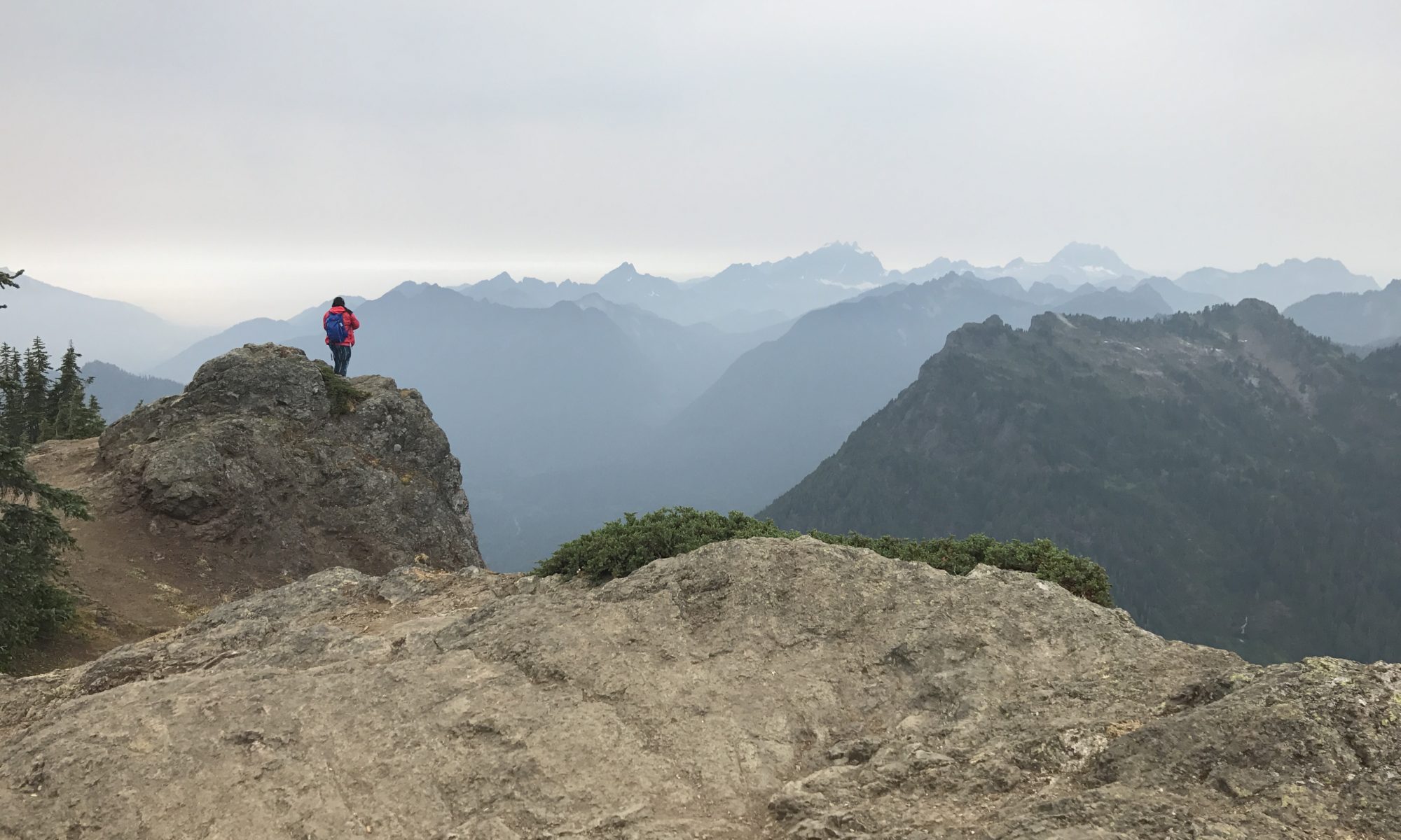
We started hiking around 3:00 or 4:00 PM so after a couple of miles we began looking for a good place to camp. We passed quite a few large campsites with fire pits both on the way in and on the way out, so if you ever decide to do this hike don’t worry about finding one! However, the best sites are near McDill Point, where I took the first photo, and on a weekend those get taken early. We ended up camping next to a plane crash, which was kind of cool but also kind of creepy. We tried to look online for information about who crashed and when, but it must have been so long ago that there are no news articles or records online.

We had fantastic weather the entire time, but it had rained recently so all the wood in the area was damp. However, with our fantastic fire-creating skills (aka lots of tissues for kindling) we had a blazing fire going in no time! We went to bed really early because that’s just what you do when you’re camping. Mainly because after it gets dark there’s nothing else to do. That meant that we also woke up early and we had everything all packed up by 7:00 AM. We had hiked about 3 miles the day before, so we had about 4.5 miles to go to get back to the trailhead. I was very surprised at how easy this was for both of us. Usually hiking with a full pack makes it much more difficult, although we didn’t have any cooking gear so our packs were probably only 25-30 lbs. I think this was a great route for a beginner (it was my husband’s first backpacking trip!) but next time I’d like to do something more challenging.